Copyright Microburbs Pty Ltd 2014-
2025
.
Contact us
for licensing
Close
GET REPORT
New
Explorer
Profile Page
Logout
Sign Up
Login
Blog
Products
Subscriptions
Suburb Finder
Suburb Reports
Suburb DataExplorer
Free Data Consultation
API Access
Consulting Services
AI Property Finder
Coming Soon
Suburb Finder
2025 Suburb Reports
AI Property Finder
Profiles
People & Lifestyle
Crime & Disadvantage
Real Estate
Affluence & Economy
Environment
Nearby Suburbs
Firle
Glynde
Hectorville
Kensington Gardens
Kensington Park
Magill
St Morris
Rosslyn Park
Felixstow
Campbelltown (SA)
Crime & Safety in Tranmere (SA) SA 5073: Is it safe?
Disadvantage in Tranmere (SA)
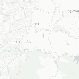
Tranmere (SA) Hyperlocal Public Housing Map
Sample Graphic
The proportion of residents under 65 who rely on government support, live in high stress environments or are otherwise alienated from mainstream society.
Sources: ABS, ATO, DSS, TORREN and Microburbs, 2001 - 2023
Tranmere (SA)
14.4%
Tranmere (SA)
14.4%
Adelaide
16.6%
Adelaide
16.6%
Compare
Suburbs
Field
Value
VS Adelaide
Trend
Alienation level
4.6
Bottom 45%
0 to Dec 2019
Homelessness (SA2)
0.4%
Bottom 34%
18% to Dec 2019
Average welfare payments (Postcode)
$6,180
Bottom 32%
20% to Dec 2019
Public housing
1.8%
Top 14%
27% to Jan 2021
Unemployed
0.1%
Bottom 41%
0 to Dec 2021
Welfare recipients (Postcode)
500
Top 17%
90% to Dec 2020
Loading entities ..
+
−
Leaflet
Subscribe
to see the map content. See samples:
Surry Hills (NSW)
St Kilda (Vic.)
Fortitude Valley
Kent Town
Northbridge (WA)
Darwin City
Glenorchy (Tas.)
Expand ↗️
Loading Choropleth Data
Min
Max
Subscribe
to see the timeline. See samples:
Surry Hills (NSW)
St Kilda (Vic.)
Fortitude Valley
Kent Town
Northbridge (WA)
Darwin City
Glenorchy (Tas.)
Profiles
People & Lifestyle
Crime & Disadvantage
Real Estate
Affluence & Economy
Environment
Nearby Suburbs
Firle
Glynde
Hectorville
Kensington Gardens
Kensington Park
Magill
St Morris
Rosslyn Park
Felixstow
Campbelltown (SA)
.png)